
- Subscription / Available world charts / Satellite charts
AngelNav can be downloaded free and includes a single chart of the UK for evaluation purposes. Most users will want to obtain charts covering the area they sail in, and currently AngelNav offers annual subscriptions for folios of charts covering the UK, Belgium, the Netherlands, Portugal, Spain and the Atlantic islands derived from data supplied by the UKHO. There are also three folios of charts for the coasts of France and two of the Pacific supplied by SHOM, as well as subscriptions to all the Imray chart folios. The charts are downloaded through the app to the user’s iPhone or iPad. Regular (every three months) updating happens automatically and is included in the subscription charge.
The update process involves making any new chart editions released by the UKHO available to the subscriber as soon as they are available. They are released every quarter and are listed in the news section of the website here. Changes described in Admiralty Notice to Mariners (NMs) may not be incorporated into the most recent chart, so subscribers are advised to check for the latest NMs (A convenient link to do this is included in the chart info screen within AngelNav).
From version 2.0.4, and for folios derived from UKHO data, the chart info button displays a notification if a new NM is published that is not incorporated into the current version of the chart. It also displays a notification if a chart has been withdrawn by the supplier.
Select a folio from the drop down menu to view its coverage:
In addition to charts available through subscription, AngelNav will open the majority of raster charts, for example those in BSB/KAP, GeoTIFF or GeoPDF format.
Many such charts can be downloaded from the internet charge, some of them free of charge. The following is a partial list of what is available:
Large scale charts based on geo-referenced satellite images may be created within the app.
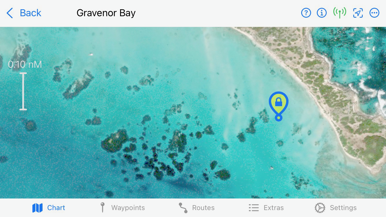
AngelNav can create charts from satellite images for use off line. Although no depth information is offered, it can be helpful for anchorages with multiple hazards (rocks, coral heads) which are otherwise not clearly marked.
It is particularly useful for islands in the Pacific for which recent hydrographic surveys may not be available.