
- the plotter for the thinking navigator
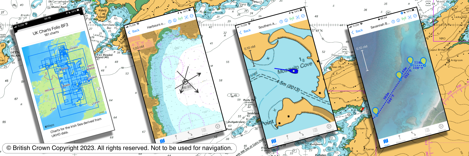
AngelNav is a new app to assist with marine navigation working via iPad and iPhone. Primarily it is a full chart plotter currently favouring raster charts, but it has many additional features including the unique ability to carry out traditional navigation directly on the screen.
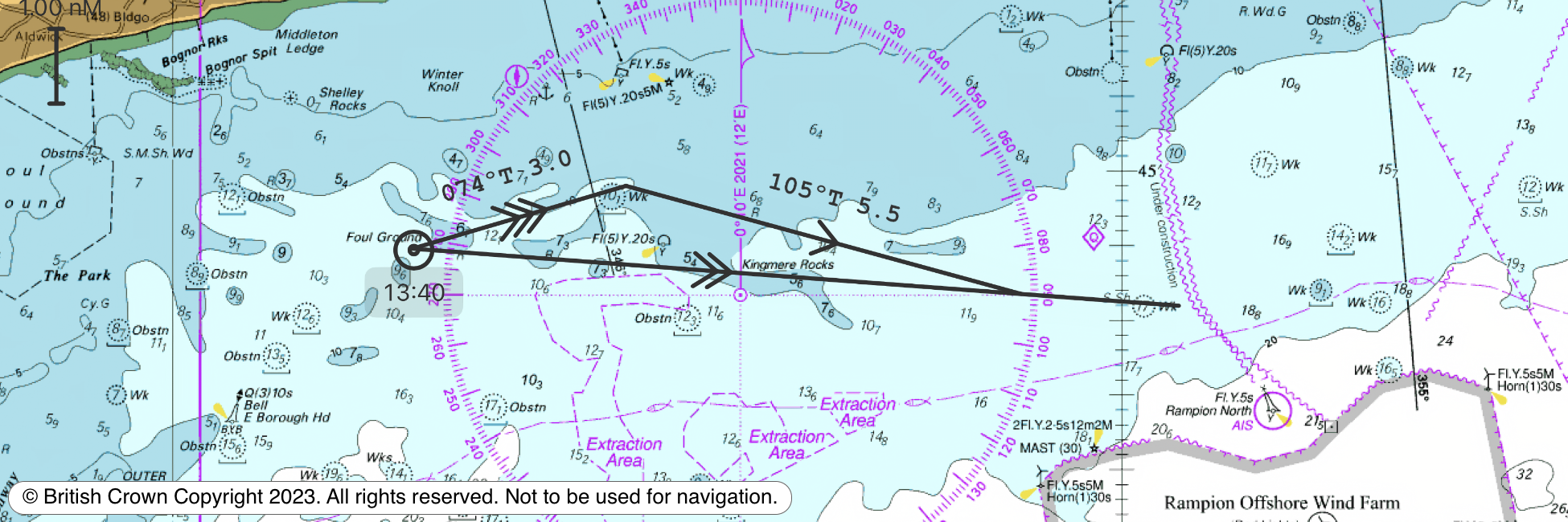
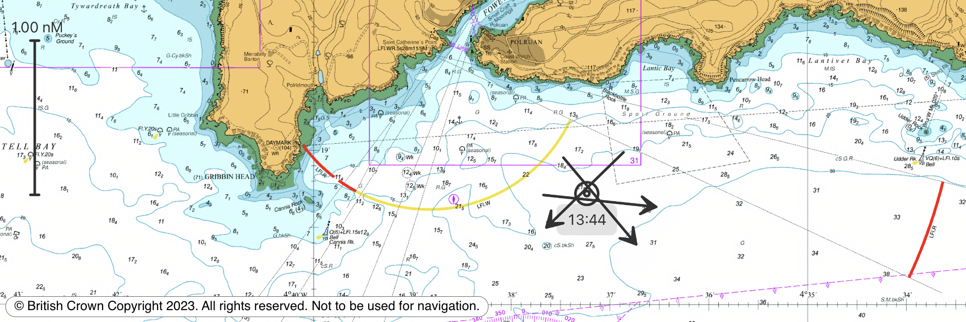
The capacity to generate classical chart work is vitally important in the event of a GPS failure, but until now it has demanded pencil, plotting tools and paper charts. AngelNav encourages traditional techniques using an electronic chart on an iPad or iPhone screen instead of a paper chart. An estimated position can be plotted, position lines drawn from sighted bearings and fixes recorded. Course-to-steer vector diagrams are readily constructed.
AngelNav reads most types of raster chart. Annual subscriptions are available as in-app purchases for UKHO derived charts, SHOM charts, and Imray charts. Details of the areas covered by subscription charts are available here. AngelNav can easily create and read its own geo-referenced satellite charts world-wide.
AngelNav can take its navigation data from the device's stand-alone GPS, the boat's NMEA over WiFi, and SignalK. It will also display AIS information on boats with a suitable receiver.
Tom Cunliffe writes:
"I believe this is a software program the small-craft world has been waiting for without realising it. I've long been a fan of raster charts and I've often wished I could plot on my electronic display in the same way I do on paper. Helping Bill Aylward solve this issue has been fun as well as highly satisfying. I'm confident we've cracked it, but it's early days. If you spot anything we've missed, don't hesitate to get in touch." Tom Cunliffe ~ sailor, author and MCA Yachtmaster Examiner
Click here for the latest news about AngelNav including chart update information
Click here for a description of raster charts
Click here to read articles in the press about AngelNav
Click here to see what sailors think about AngelNav
AngelNav is brought to you by Tom Cunliffe and Bill Aylward.
AngelNav can display most types of raster charts.
AngelNav is intuitive to use, but has many powerful features.